Geospatial intelligence · Patna, Bihar
From Data to Decisions.
We turn maps, satellite and drone imagery, and sensor data into decisions for government, industry and academia, and we train the people who make it work.
- Registered Pvt. Ltd., RoC Bihar
- Open-source-first stack
- Indian-owned, Bihar-based
Built on open, proven geospatial tools
- QGIS
- PostGIS
- GeoServer
- Leaflet
- OpenLayers
- Google Earth Engine
- Sentinel
- Landsat
- ArcGIS
- Python
- GeoPandas
- Rasterio
- R
- TensorFlow
- PyTorch
WHY WE EXIST
Spatial data is everywhere. Decisions built on it aren't, yet.
Departments, companies, universities and NGOs hold spatial data that is fragmented and underused. At the same time, GIS graduates leave college without the practical skills industry wants. We work on both gaps at once.
The technology gap
Data sits in silos, disconnected from planning.
Land records, satellite imagery, drone surveys and sensor feeds rarely meet in one place, so they rarely change a decision.
The workforce gap
Graduates know the theory, not the project work.
Our academy trains on live projects, and its best trainees join our own delivery teams. Every project we run should leave the client's team more capable, too.
HOW A QUESTION BECOMES A DECISION
One question. Four steps. A decision you can defend.
A flood-response example on the Ganga at Patna, the kind of work behind our Bihar Floods 2026 assessment. Step through it, or let it play.
Real places on an OpenStreetMap basemap. Flood extent, gauge readings and risk scores are generated sample data, not an assessment.
WHAT WE DO
Eight lines of work. One accountable team.
From a one-off map to a platform your staff use every day: consulting, imagery, software, AI, sensors, research support and training, under one roof.
DISASTER INTELLIGENCE IN PRACTICE
We publish our work, not just promises.
Our independent Rapid Damage and Needs Assessments (RDNA) show what our analysis looks like. They support, and never replace, official government assessments.
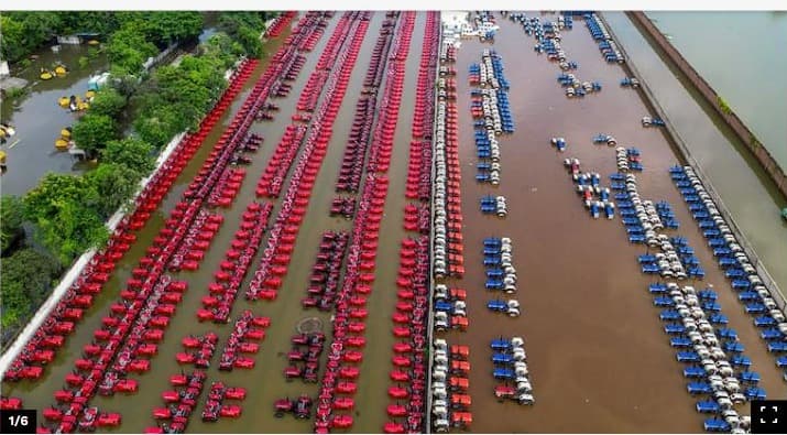
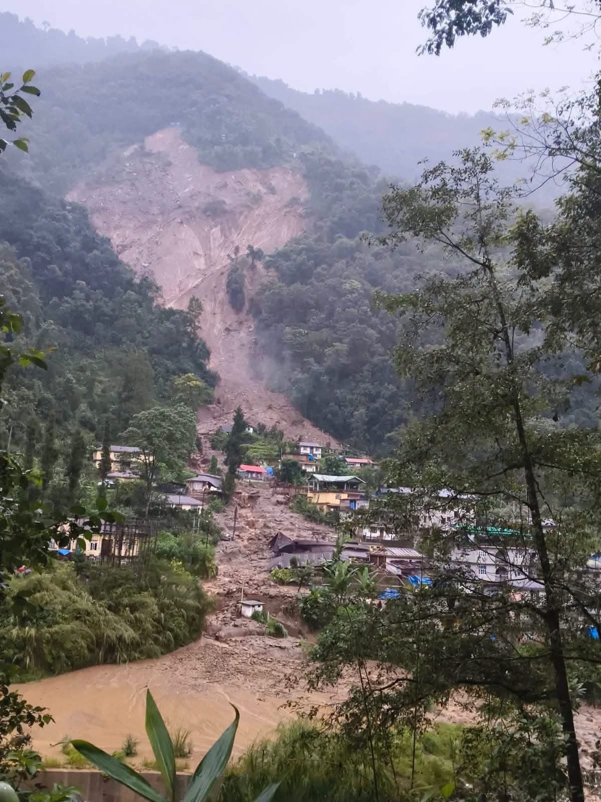
What an RDNA gives you
- A consolidated picture within days of an event
- Satellite and terrain observations alongside field reports
- Priority early-recovery and longer-term needs
*About 50 lakh people affected as of 23 September 2026, from official bulletins consolidated in our report.
WHO WE SERVE
Four kinds of client, one standard of work.
Bihar is home ground; neighbouring states come next. We balance long government timelines with faster industry, academic and development work.
Who
- State GIS cells
- Urban Development, Revenue & Land Reforms, Disaster Management and Agriculture departments
- Pollution control boards and weather services
- Municipal bodies
What they need from us
- Land records and parcel mapping
- Infrastructure planning
- Disaster risk mapping
- Air-quality and flood monitoring
HOW WE WORK
Six steps, from first enquiry to long-term support.
Every engagement follows the same path, so you always know what happens next and what you'll receive.
- 01
Enquiry
Tell us the decision you need to make. A named lead owns your enquiry from day one.
- 02
Scoping
We agree the question, the area, the data needed and the deliverables, in writing, before we quote.
- 03
Data collection
Satellite imagery, drone surveys, field apps or sensor nodes, whichever the question needs. Open data first where it is good enough.
- 04
Analysis
GIS, remote sensing and AI models produce the answer: maps, risk scores, change detection.
- 05
Delivery
A report, dashboard or Web GIS platform, plus a walkthrough so your team can use it.
- 06
Stay on
Maintenance, subscriptions, sensing services or staff training, so the work keeps paying off.
PLATFORM · IN DEVELOPMENT
A Web GIS platform that turns projects into products.
We're building a cloud-based Web GIS and decision-support platform, starting with one high-value workflow for our first pilot clients. It isn't live yet, and we won't pretend it is.
Interactive map dashboard
Data management
Analytics & AI layer
Reporting & export
Field data app
Admin & roles
TRAINING ACADEMY
The skills we use on client work, taught on real projects.
Four tracks from beginner to advanced, run as certificate programmes, short workshops, corporate and faculty training, and internships on live projects.
GIS
From first map to spatial database: the core toolkit every GIS role screens for.
Remote Sensing
Read the earth from orbit and from the air, then measure how it changes.
Programming
Automate the repetitive work and build maps that run in a browser.
Data Science
Turn spatial data into evidence: statistics, models and dashboards.
WHAT WE STAND FOR
Five principles behind every project.
Decisions over maps
A map is only useful if it changes a decision. We start every job from your question.
Honest about what we have
We never oversell. Products in development are called that; estimates are labelled estimates.
Affordable by design
Open-source first, paid tools only when they earn their cost, so smaller clients can afford us.
Teach as we go
Interns and trainees work on real projects, and every project leaves your team more capable.
Compliant by default
Filings on time, data handled within the law, every legal document checked by a professional.
Legal name
SkyMantra GeoIntelligence Private Limited
CIN
U62099BR2026PTC088270
Incorporated
22 September 2026 · RoC Bihar
Registered office
Patna, Bihar, India
LET'S TALK
Have a project, a partnership idea, or a cohort to fill?
Tell us what you're working on. We respond within 2 business days, and the first consultation is free.